Home > Google Earth / Maps

Google Earth / Maps

Between Cancer and the Google Earth use for the cadastre

google earth precission

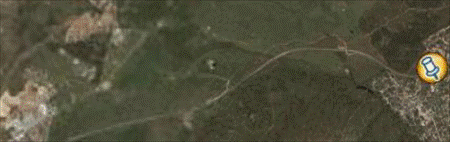
From a good humor moment with a Dutch friend, this day, I rescue some similarity between the process that leads cancer in clinical psychology and Google Earth romance with wrong purposes: Stage 1: Fright. A technician goes to field in response to a measurement request of an owner who wants to sell; He checks that there are new buildings that ...

Read More »

How accurate are the images in Google Earth?

google earth precission

The theme of orthorectified  and satellite images’ precision of Google Earth is a record question in search engines; in these days where confusing precision with tolerance is as easy as losing the GPS in the taxi, it would be good to make a couple of analysis about whether or not to use these data for serious work. Now there´s in ...

Read More »

In Google Earth pro, do images have better resolution?

Apparently there is some confusion about what Google Earth paid versions offer; there are those who believe that they are obtained coverage of better resolution. Indeed, you get better resolution, but no more coverage than what we see, what these tools offer is output better quality, for example to view, print, save, or send to pdf formats, though the coverage ...

Read More »

Practical use of historic images from Google Earth

It was one of the best Google Earth changes implemented in version 5, while allowing us to see what images are published annually, enables us to use the ones which have better resolution or relevance for our purposes. In many cases, because the most recent image has clouds that hide the object of our interest and in other cases because ...

Read More »

How to insert local images in Google Earth

In response to some questions I receive, I take advantage to leave the outcome for public use. Some time ago I had spoken how you can insert images linked to Google Earth point, but using Web addresses. In this case I want to show it using a local path: Assuming that the file is set to C: / Users / ...

Read More »

Geomap and its link with Google Maps

Some time ago I did a review of the Geomap beta version, which among its best features has ability to synchronize data views not only with Google Maps, but with Bing Maps, Yahoo Maps and Open Street Maps. Unlike what other programs do, that only import a georeferenced capture, Geomap has support for loading tessellating maps, mosaics that in bricks ...

Read More »

Import Google Earth’s image and 3D model

Microstation, from version 8.9 (XM), brings a number of features for interacting with Google Earth. In this case I mean the import of three-dimensional model and its image, something like is done by AutoCAD Civil 3D. These functions are activated by: Tools > geographic or in case Microstation is in Spanish, which in practice is hard to adapt: Herramientas > ...

Read More »

StitchMaps, common problems

Stitchmaps was one of the best applications that were made to create orthophotos from Google Earth captured mosaics; I spoke about how it works long ago. Those like me, who did this process before manually, downloading Google screenshots and then linking them with PhotoShop or Bentley Descartes, know that Stitchmaps does much more than that. Each capture requires a special ...

Read More »

Google Earth; visual support for cartographers

Google Earth beyond being a tool for general entertainment has also become a visual support for mapping, both to show results as to review if work done is consistent; it also serves as a teaching tool for geography or geodesy classes. In this case I’m going to get assisted by Manifold GIS to build the quadrants and by Google Earth ...

Read More »

KloiGoogle to connect Google with your GIS program

This is an application that goes beyond the simple, but in practice resolves what we all want to be as simple like: On this side Google Maps —-> Satellite layer Hybrid layer Map layer Topographic layer On this side my GIS program ArcGIS Mapinfo GeoMedia Microstation Bentley Map For a moment I thought it was something similar to what Plex.Earth ...

Read More »

Antique maps in Google Maps

Some time ago I had seen on the Google Earth’s official blog, but after that Opaco has reminded us, I took a few minutes to see it working. I mean the old maps from the Rumsey collection made on Google Maps or Google Earth. This example shows a map of the Iberian Peninsula in 1710, Spain divided by Castilla and ...

Read More »

Google ContouringGE, it can be done!

TRANSLATION NOTES: Please read some comments at the end of this post. A few days ago a friend asked me how to do to see the contour lines in Google Earth using an application called ContouringGE 1.1 that is supposed to work with any 4x version, Windows XP or Vista. And because definitely I couldn’t, finally I did it but ...

Read More »

MapEnvelope and London Eye

MapEnvelope is an interesting and simple smoke of a guy with a great taste for creativity. If you ever wanted to surprise saying where you are in a different style, MapEnvelope as its name suggests, generates an envelope with printed map. It is only necessary to enter the location, for example: London eye, London, uk And automatically displays a Google ...

Read More »

Draw on line on Google Maps

Let’s imagine that we need to send a client a sketch map so he can view it online or in his GPS Navigator. For example, if we have a parcel for sale with the path to get there and its road’s indications. Another example could be an area of the MODIS satellite view from that day that we hope to ...

Read More »

It’s available PlexEarth Tools 2.0 Beta

One day ago I spoke of the new features that would bring PlexEarth Tools for AutoCAD’s version 2.0, one of the most practical developments that I have seen on Google Earth from a member of the Autodesk Developer Network (AND). Today it has been released the Beta version, which can be downloaded, tested and what is important in these stages: ...

Read More »

Google Maps from MobileMapper 6

And just think that my technicians walked with these toys nearly a year; just only to tell me, at last, that they don’t understand them and preferred to stay with the Pro. Well, let’s find a way to give use to a couple of GPS Mobile Mapper 6, which I hope to get on with a Promark 3 as a ...

Read More »