This Wednesday, April 15, 2009 will be a new Civil3D web cast on the management of topographic data among which includes data downloading, surfaces’ generation and cross sections. To do this you need to sign in, have a respectable connection, and meet between 12 and 13. Import, design and exportation of topographic data with AutoCAD Civil 3D Import data field ...
Read More »Tag Archives: Civil 3D
Connect to the data, AutoCAD Map – Bentley Map
In this post I want to make a comparative between the access’ ways to a database with geospatial platforms from Autodesk and Bentley. I’ve used for this: AutoDesk Civil 3D 2008 (which includes AutoCAD Map) Bentley Map V8i AutoCAD Civil 3D 2008 Bentley Map V8i Connect to: File, connect to Data… Connect to: Settings, database, connect AutoCAD concentrates here all ...
Read More »The names of AutoCAD’s 2010 project
In Between the lines has been published the names of the various AutoCAD’s 2010 version projects; it is often used a nickname while the version receives a number to be released. When we are invited to participate as testers, this is the name by which we’re invited … and most times, reflects the project’s manager personality. By the way it ...
Read More »egeomate, a month, a post
If I have to recommend a post per month, this would be the result June 2007 How Google Earth does change our world? July Google Earth for land use? August A love history for geomatics September How precise are images of Google Earth October A projection not based on tables November AutoCAD and its 25 years December Can you impress ...
Read More »Bentley Cadastre, Schema wizard
In an earlier post, I’ve spoken about Bentley Cadastre’s logic and origin, which itself is a Bentley map oriented application for plot management that takes advantage of xfm infrastructure and topological control. In my opinion, Bentley’s Cadastre implementation occupies an alien smoke (a Spanish idiom: “fumada extraterrestre”) in case of walking from scratch; it may be easier for those already ...
Read More »From Excel to AutoCAD, more easier than ever
We had already discussed this before, more over, we had done a summary of the best, but I couldn’t avoid the temptation to speak about one simplest version a Cartesia’s Forum user had uploaded precisely today. It’s a simple Excel spreadsheet with columns for entering data, dot’s name and xyz coordinates, perfect for points’ management. These are raised using total ...
Read More »Designing a Solar Plant with AutoCAD Civil 3D
It has been announced a webcast where we can learn about AutoCAD Civil 3D’s applications to solar plants. This will be on March 26, 2009 at noon (12:00 or 13:00 hours, according to Madrid time, I guess). The webcast content includes: The creation of a digital terrain model (MDT). An MDT analysis using longitudinal and transversal profiles An MDT edition ...
Read More »The slow progress of CAD integration– Costs
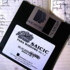
After SAICIC’s death, several Mexican programs appropriated this market, making it one of the engineering areas that was first automated. I remember that sometimes I’d trained costs’ course, and it was necessary to test different applications (available in those days), such us NewWall, Opus, Campeon Neodata. The latter seemed better even it bothered me I couldn’t distribute it in my ...
Read More »AutoCAD Civil 3D, importing points from an external database
In this post we will see how to import data from an external database, but we have to consider some extra aspects in handling points. We will work with the example that comes with a tutorial of Civil 3D, using file-1.dwg and points.mdb at the end are links to download them. Create Description Keys The aim of this is to ...
Read More »Learning AutoCAD Civil 3D, valuable resources
Being a member of AUGI MexCCA has many advantages, one of which is the access to learning tools and tutorials. Here I present a summary of the best from the tutorials in Civil 3D use for highways, surveying, and geospatial. Some are videos, other are pdf files. You must be registered to view them, so you must enter your username ...
Read More »Creating a table of bearings with AutoCAD Civil 3D
I remember a while ago talking about how to do this with SoftDesk, we also saw some juggling to do the reverse from a table built into Excel. In this case I’ll do it with AutoCAD Civil 3D, which is the union of AutoCAD Map and AutoCAD Civil 3D. Indeed, the environment is much like Land style, so we knew ...
Read More »Working shape files with AutoCAD
The shape files, known as .shp files will be quaternary formats in matter of technology but we can not avoid that they have been popularized as much as it was ArcView 3x. This is why they are still widely used, to the extent that most platforms especially geospatial have developed routines to operate them. Even gvSIG can read and edit ...
Read More »Toy to connect AutoCAD with ArcGIS
TRANSLATION NOTES: Please read some comments at the end of this post. Clarifying what AutoCAD We do not mean AutoCAD Map or Civil3D, that connect to OGC services but the simple AutoCAD 2007 versions onwards, we mean since it had georeferencing functionality. Clarifying what ArcGIS: Did not connect to a Geodatabase or a locally stored mxd neither a service created ...
Read More »连接AutoCAD与ArcGIS的玩具
翻译注:请在结束这篇文章读了一些意见。 澄清的AutoCAD 我们的意思不是AutoCAD的地图或Civil3D,连接到OGC服务,但简单的AutoCAD 2007版本起,我们的意思是,因为它的参照系功能。 明确的ArcGIS: 未连接到地理数据库或存储在本地的MXD 既不是传统的ArcIMS的(它没有说通过创建服务) 但通过ArcGIS Server的创建,无论是在本地主机,Intranet或Internet服务。 澄清玩具 这是一个免费工具由ESRI称为“为AutoCAD的ArcGIS“,下载并安装,允许从AutoCAD,它可以称得上是由ArcGIS Server提供的数据服务。 需要说明的URL服务,覆盖类型下载。 然后,它被存储在“层管理器,它可以被管理的,就好像它是一个层。 它还尊重的符号和属性,因为它是画在ArcGIS中,可以将数据从相关联的表咨询。 这似乎给了我们一个很好的主动改善与通用的CAD工具的互操作性,因为在这一点上 人群(*)导入和导出选项的理解是要被淘汰,但需要看到的人说什么,如果他们低的水平,就可以通过的ArcSDE地理数据库。 在这里,你可以 下载 它 在这里,你可以看到 视频 的玩具在行动。 翻译注意: (*) 马拉: 这意味着很多人,人群.
Read More »AutoCAD Civil 3D Solutions, for housing developments
AutoDesk will be presenting a webcast on applications for planning, construction and civil work this December 18 and January 29, 2008. Lately this is an online and in real time way to learn about programs features, in this case products innovations, also you can participate in discussions and questions about the submission, without leaving home or Office. Participation in the ...
Read More » Autocad Software, Bentley Microstation, Gis Google Earth, Gis System Geomate Provides Services For Complete Gis Software And Solutions, Autocad Software, Autocad Courses, Bentley Microstation, Microstation Software, Gis Google Earth, Open Source Gis And More.


