Home > Tag: gvSIG

Tag Archives: gvSIG

What is going to be in the Free GIS Conference of Girona

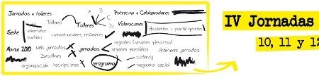
Three months after the beginning of the IV Conference, to be held in the 10 to 12 March, this is the proposal of what we might see there. IDE / OGC IDE Open Source: The way towards INSPIRE. Spatial data Infrastructure from Venezuela, an IDE made with100% free software. Integration of the WMS-C recommendation on pre-existing standards in the IDE. ...

Read More »

SEXTANTE, gvSIG + 220 routines

As well as GRASS complements Quantum GIS, SEXTANTE does the same with gvSIG, keeping the specialty. These are the best efforts of collaboration between open source alternatives in the geospatial environment, searching to prevent unnecessary duplication. The gvSIG effort of maintaining vector handling with many CAD capabilities is complemented with everything that has been built in SEXTANTE after its abandon ...

Read More »

eGeomate: Predictions 2010: GIS Software

TRANSLATION NOTE: Please read the comments at the end of the post to clarify the real meaning of some terms. ——– A couple of days, at the warmth of a stick coffee (Spanish Idiom: “café de palo” a kind of coffee entirely prepared at home without any electrical artifact) made by my mother-in-law, we did some hallucinations on marked trends ...

Read More »

…What a month…

…It has arrived gvSIG stable 1.9 …We are about to start mounting the IDE on mapserver … Hit State, restitution, another coup, elections, nobody knows already what will happen … My brother is going to get married and the motorcyclist star too …Version 3.0 of geofumadas.com is almost ready But this month, working by day, night and early morning, there’s ...

Read More »

gvSIG 1.9 stable has arrived. Hooray!

This week has been released the stable version of gvSIG 1.9, from which we had the RC1 in August and the Alpha version in December 2008. This version will possibly make history, because maturity is enough to promote it for municipal use, without being belittled by smallness made by ArcView 3x and not done by gvSIG 1.3. They have faithfully ...

Read More »

Apply transparent colors in images

Many images have been cut from polygons, but in doing so, it has not been set a transparent color to the background and that’s why an uncomfortable black color appears. Or in other cases, we wish not be visible a range of colors; let’s see how to do it: With gvSIG. I’m using stable version 1.9, which download madness ended ...

Read More »

gvSIG, what is going to be in the 5ths Workshops

It has already has been announced a preliminary version of what it could be in the fifth gvSIG workshops that will develop in the Events Centre of Valencia, from December 2 to 4, 2009. Much of the work presented is from Spain, although there are some experiences from Germany, Italy and there. It also calls attention some American environment projects ...

Read More »

gvSIG: 21 CAD tools

A common weakness in specialty GIS programs is its limitation to construct data with the ease that offers CAD-oriented tools. Gradually, the gap is narrowing, although it is questionable whether the GIS has had an improvement in their ability to build or CAD have implemented variants such as Bentley Geospatial Map and AutoCAD Map. gvSIG 1.9 has made almost a ...

Read More »

Caceres’ GIS

This is one of the projects that became a finalist for the award of the Be Inspired 2009 in the category of Cadastre and Land Development. They also made a presentation which was in charge of Luis Antonio Alvarez and Faustino Cordero, with a very good PPS presentation, videos and also a printed map. The day of the award I ...

Read More »

The software value

The price is in the box, the cost in our motivation, the utility in the use we give it, the value in our appreciation. This is a rather sensitive issue depending on the point of view of the one who is giving his opinion, on what he works at, and on the one who pays their expenses; usually we associate ...

Read More »

GvSIG Courses in Valencia

From the first quarter of 2010, the Florida University Central Training courses will be offering gvSIG, which to date has been provided as an adjunct to the Interior tourism specialist diploma courses. This course has a lasting of 20 hours over two weeks, and is aimed at professionals, technicians and officials who wish to enter the GIS field using a ...

Read More »

Portable GIS, all from a USB

It has been released the 2.0 version of portable GIS, a simply wonderful application that can run the necessary programs for spatial information management using both desktop and web interfaces; through different devices like external drives, USB memory sticks or even digital cameras. What’s its weight? The installer file weighs 467 MB, but it takes at least 2GB USB free ...

Read More »

Global Mapper, working with dgn format

Reading the dgn format is a standard in most of GIS or CAD programs, but several of these software (including Manifold GIS and gvSIG) are still reading the V7 format. AutoCAD and ArcGIS have already achieved it. Let’s see how Global Mapper does it: 1. Reading dgn V7 It is interesting that files can be in a compressed archive of ...

Read More »

Sinfogeo: GIS distance courses

Very few times we have seen an offer in the GIS area as the one offered by Sinfogeo. The opportunity is not only to learn but for specialists, which can track students and build online training manuals. Being online it can be taken from anywhere in the world, but are available in classroom (in Spain). They are not free, nothing ...

Read More »

gvSIG 1.9 RC1, ready to download

It is ready for download gvSIG 1.9 RC1, the first distribution of the candidate version (Release Candidate) from August’s Build 1243 of 313. The download took a while, because it was out of service initially gvsig.org, where builds are lowered, and then the available unzip and run version appeared as a corrupt file. But finally, here it is, for our ...

Read More »

gvSIG: The hazards of this and other trades

The way free tools have matured is interesting, some years ago, talking about free GIS, sounded like UNIX, in a geek voice and with a level of distrust or fear of the unknown. All that has changed much with the diversity of solutions that have full-grown not only in the construction of routines commonly expected but overcrowding innovative strategies, testing ...

Read More »

Engineering, GIS and local management: courses coming

At least these are courses that are coming in Latin America, there is now available the possibility of applying them: Soil Markets: Event: course Soil Markets’ Empirical Methods in Latin America Date: 19 – 23 October, 2009 Place: San José, Costa Rica Summary:  This course is designed to familiarize researchers and people working in the soil field policies with the ...

Read More »

Quantum GIS, first impression

If gvSIG friends fulfilled their promise, next Monday July 27th we will have the 1.9 stable version. So far the test has been great, according to the perceived volume of distribution lists. While waiting on Monday, by which time I hope to have the satisfaction of congratulating the performance of speech, at the cost of surely sleeplessness developers, let’s take ...

Read More »