TRANSLATION NOTES: Please read some comments at the end of this post
Consider the case:
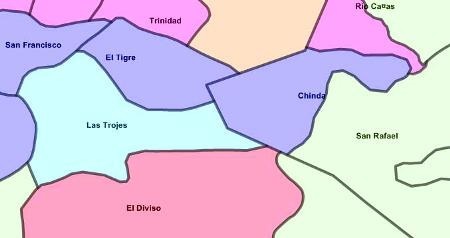
I have an ArcView layer containing the villages’ jurisdictions of a zone in shape format, and I wish to import it into Microstation Geographics. Let’s see how to do it:

Importing vectors
 It is necessary for this to open a project in Microstation Geographics, in this case I have one connected to an Access database through ODBC.
Select “File / import / shp, mif, e00 …” and it displays a control panel where you select the file to import using “file / select import file.”
It not only can import data in .shp format but also from Mapinfo (.mif) and ArcInfo coverage as in the old way ( format .E00).

After selecting the format, you must choose the attribute that will receive vectors to be imported, so it is chosen the attribute for boundary and centroid according to the case. You must also choose the type of data: point, line or area and the format of the source and destination units.
If you do not want to import the database, import is very fast, you can also choose only one area using a fence.
 Another available option is the possibility that import process do a topological clean so that it do not bring shapes but linestrings with nodes free of dirt … this is a good alternative if we remember that ArcView do not handle topology so that was the reason data used to be dirty because of not careful (*) maintenance.

Importing data
It must be selected the option “import attribute table”, and then indicate which name will take the table in the Access database and what columns we want to import. In some cases I have seen that .dbf files with a name that contains spaces or unusual characters generate problems.
In case of be a lot of data to import, you can select a “tile step”, such that when rows and columns are indicated the system will perform the process under a spatial index and may improve performance.

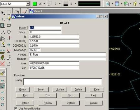
![]() Once imported data, the centroids and shapes have a link to the database, such so that when consulted with the “data review” button it rises the existing attribute table. To activate this icon do “tools / geographics / geographics”
Once imported data, the centroids and shapes have a link to the database, such so that when consulted with the “data review” button it rises the existing attribute table. To activate this icon do “tools / geographics / geographics”

 Labeling data
Then imported the data it can be extracted from the Access database information using “Database / the annotation”, which lifts a panel in which you can open the query builder, select the table and column where we want to bring the text.
Additionally you can choose the text format, type of element (cell, text, point), offset and if you want to concatenate data.
Any data extracted from the map is brought to the link, so that you can do “data review” of this.
And that’s ready, gentlemen

TRANSLATION NOTES:
(*) al chilazo: It’s an expression which means that something has not been done with special care.
 Autocad Software, Bentley Microstation, Gis Google Earth, Gis System Geomate Provides Services For Complete Gis Software And Solutions, Autocad Software, Autocad Courses, Bentley Microstation, Microstation Software, Gis Google Earth, Open Source Gis And More.
I need to import .shf into Microstation v8.05
I need also to import .dwf into uStn v8.05
file/import offers me Iges, CGM.
are there translators available?
No in Microstation. Microstation Geographics 8.5 make most import choices, like Mapinfo, Arcinfo and ArcView GIS files.
But just Microstation doesn´t have more file type imports.
I think you can translate the dwf to dwg with AutoDesk Trueview, it´s free.
With the .shf you have to open it with a propietary software and export it to dgn.
Best regards