For now is one of the better (if not the best) CAD / GIS data viewers I’ve seen, practical and free. Tatuk is a product line born in Poland; just a few days ago it was announced TatukGIS Viewer version 2.
Other viewers
If we value the free programs of other brands, provided to view data you will find at least one of the following characteristics:
- Don’t open projects such as: ArcView 3x apr, ArcGIS mxd
- or MapInfo map.
- Don’t load MicroStation V8 dgn files
- Don’t load kml formats
- Display some formats only importing them
- It can’t be saved layers configuration as styles
- It can’t be saved as project

What data is read by TatukGIS Viewer
When you see the functionality and ability to interact with other formats, it can be noticed that the viewfinder is almost TatukGIS Editor, without editing capabilities, analysis and some reading formats such as OGR and FME. Perhaps this is why it goes beyond what viewers of other programs do, whose focus is almost in their own formats and with an approach on just see and print.
| vector Formats and common CAD | -DGN V8 (most don’t) -DWG 2000 (here goes wrong) -DXF ASCII and binary -GPX -WFS |
| GIS Formats | -E00 ASCII and binary -GML -LAND XML -MID/MIF/TAB/MAP (Mapinfo) -SHP -GML -JSON -KML -Open Street Map |
| Database | -ESRI personal data base -Geomedia SQL Access Warehouse -SQL BLOB (Simple Features) -SQL Normalized (Simple Features) -TatukGIS SQL binary |
| Raster Formats | -Maaaaany, including: WMS, MrSID, BIL/SPOT, IMG, ECWP server based, ADF. |
| Projects that read | -ArcView 3x -ArcExplorer -ArcGIS (there’s a conversor) -Mapinfo -TatukGIS |
Which attractive functionalities have
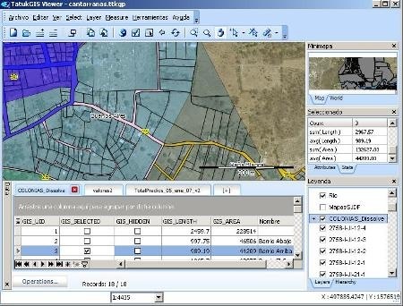
Very clean interface, with side panels to the right, style Manifold, which includes selected object properties, project layers and a mini – map, down it can be load the attribute tables in attractive tabs. All can be dragged as floating windows or move very freely.
Loading of layers. Layers are load, it recognizes in a wonderful way the projection of many CAD/GIS formats and re-projects on the fly in the Viewer’s projection. Supports scale viewing, transparency, hierarchy, cache and rendering. It also can be done layer groups.
Styles to layers. It can be applied themes to layers, for line type, fill, fill pattern, graphics bar, pie, etc. These layer properties can be saved with .ini extension to apply it to others.
Tags. In the layer properties it can apply labels with very attractive styles that can be static or dynamic when displaying for being moved and seen while the layer is visible. It includes HTML rendering.
Aid. Allows you to choose a table attribute that is  displayed when the mouse is over the object (hints) and also deploys hyperlinks if there are in the tabular data.
Measurement. It has tools (no snap) of rectangles, circle, path, polygon, rectangle angle. When you right-click to copy the coordinates to the clipboard.
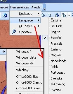
Language and style. With a simple click you can choose the language among which is the Spanish, and also the style interface.
Printing. It has a fairly practical and print functionality, including for export to pdf.
Speed. All this is done with a very surprising agility; I’ve loaded 14 orthophotos ecw, 16 dgn maps, connected to an ArcView apr with 11 layers and from an Acer Aspire One … pans very well.
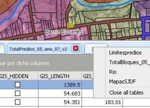
Tabular data. It’s very interesting the tables deployment, as uDig style it handles  tabs that are added with a simple click from the layers of the project. The spatial objects properties are displayed as area and length; one interesting aspect is that objects can be touch individually and be chosen the option of not visible even if layer is. There are also a series of filtering processes, individual and by group selection.
Save project. The project can be saved, in the style of a mxd/apr with .ttkgp extension to open it again; by simple it resembles, it can be deployed by TatukGIS Internet Server as ASP.NET service.
Conclusion
Definitely, it replaces what any free viewer mark program do, at a very efficient deployment speed. The best is interaction with formats, standards and program projects of popular programs use (ESRI, OpenGIS, Bentley, MapInfo, Google Earth). Not bad for free.
See more of TatukGIS Viewer
Download TatukGIS Viewer
 Autocad Software, Bentley Microstation, Gis Google Earth, Gis System Geomate Provides Services For Complete Gis Software And Solutions, Autocad Software, Autocad Courses, Bentley Microstation, Microstation Software, Gis Google Earth, Open Source Gis And More.
We are a Dutch company SmallToGo and act as value added reseller for TatukGIS in the Benelux. We have however worldwide customers whome we help in training, custom made application development, support and maintenance.
We are the experts in TatukGIS Development and give you the best performance and functionality available.
We can write your code in our office and send you the solution by mail or we use a vpn connection
The Viewer is one of the best free applications and supports a long list of file and database formats.
A perfect tool to administer small websites made in TatukGIS DK.ASP.NET e.g.