These days I will be busy, I hope your patience but I have to smoke the green for this; I want to connect a system with data in MySQL with the mapping system stored in Manifold GIS.
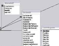
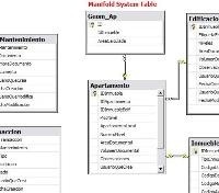
Manifold does this via ODBC in a simple way, also from MySQL I could create a data service that can be pasted to Manifold but what I want is to connect an application that has many data from cadastral data sheet stored in different tables and serving me them towards the parcel layer intending to make for example:
If I want to create a theming of all the properties whose use is for family’s housing with block / brick materials and with inferior workmanship quality.
 I also want this Land Management application will show me the Manifold map served via IMS so as to be printed in the cadastral tab certificate of valuation.
 The municipal system is developed in Visual Fox, with data stored in MySQL. While development language is half forgotten, the system is very efficient and can store both real estate registration and appraisal data with a methodology based on use, class of materials and quality of labor. In the other side, the Manifold’s project is stored in a .map file with IMS services via IIS with asp.NET programming.
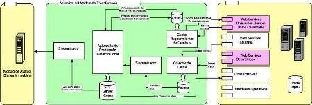
Later I want to connect this to a Land management control service (which is already built) developed with Manifold API, which stores data in SQL Server 2003 with transactional control over alphanumeric data and geometry and that is connected to the national system via web services … that is in Oracle 10g and geometry in MicroStation Geographics V8.5 … but will talk about this another day.

To keep things simple I will do it through recruitment of technicians who developed the municipal system.
These are the products I hope:
- 1. A technical, chronological and economic proposal containing the work plan and goals.
- 2. An interface module consists of a data service serve via ODBC to MySQL and SQL Server 2003 to enable the information deployment contained in the cadastral tab within the Manifold GIS environment and with the functionality to pick up the tab management system in the property selected from the map.
- 3. An information display module for the cadastral card management system showing the spatial information served via IMS (asp. NET) using Manifold GIS under HTML, as well as the functionality to lift in Manifold GIS the property selected in the screen.
- 4. A practical guide for use of the developed functionalities
- 5. A CD containing the source code with modifications for the exclusive use of the municipality selected.
- 6. A commitment letter that represents the responsibility for maintenance and support for thirty days after the final delivery.
- 7. An 8-hour training to ensure knowledge transfer both at user-level module as at administrator level.
- 8. A final report that reflects the scope and results obtained.
We will see how it is going to these geniuses of the code.
 Autocad Software, Bentley Microstation, Gis Google Earth, Gis System Geomate Provides Services For Complete Gis Software And Solutions, Autocad Software, Autocad Courses, Bentley Microstation, Microstation Software, Gis Google Earth, Open Source Gis And More.